hike-centric · island

Madeira

Twenty-three days, 4,271 photos, 112 km on foot

14 January - 5 February 2023

Read from 4,271 photo timestamps, 10 recorded hikes totaling 112.2 km, and locality breakdowns across all four Madeira regions.

Twenty-three days at Calheta on Madeira’s south-west coast, walking the island’s levada-and-peak network until there was over 112 km of it recorded - our second 100-km-plus hiking trip. From the one base, seven distinct regions: Funchal and Câmara de Lobos on the south coast, the lava pools of Porto Moniz in the north-west, the wild north at São Vicente, the thatched houses of Santana, the first settlement at Machico in the east, the near-home villages of Ponta do Sol and Ribeira Brava, and the high Pico do Arieiro to Pico Ruivo ridge traverse. The single biggest day was the cross-island run east to Machico.
Duration
23 days · 22 nights
Country
Portugal (Madeira) · 1 effective
Anchors
1 (Calheta · 17 days at the locality)
Path shape
home → Calheta base 22 days → multi-country return-drive → home
Photos
4,271 (4,240 PT · 31 across 5 return-transit countries)
Photo density
186 / day · 484 peak
Hike signal
112.2 km recorded · 10 hikes
Hike rank
2nd-densest hike trip across our trips (after 2021 Tenerife · 103 km)
ramp up · regional discovery

Wk 1 · Jan 14-20

1806 photos
Active window
high baseline immediately
Peak hour
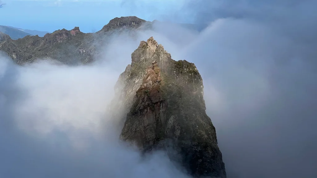
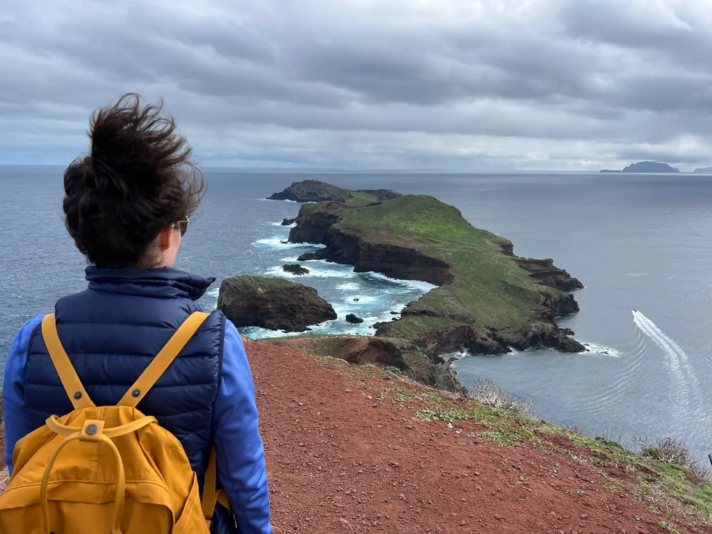
Jan 20 · cross-island to Machico

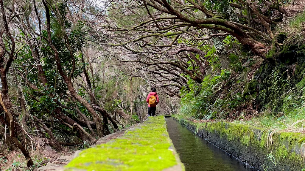
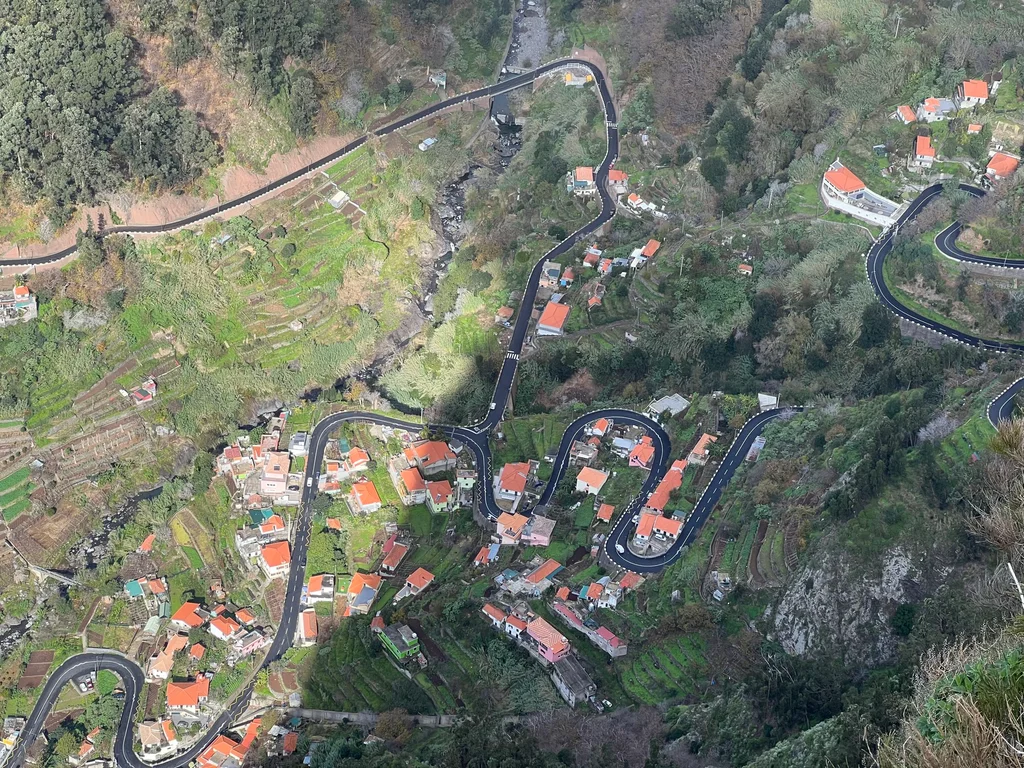
A quiet arrival, then straight into a run of full, dense days - the Funchal axis, two visits up to the Porto Moniz lava pools, the north coast at São Vicente. Hikes started on day four with the Levada Nova - Levada do Moinho loop near home, and crested on Jan 20 with the Ponta de São Lourenço walk across the eastern tip, the trip’s photographic peak and the only proper visit to the island’s first-settlement region. By the end of the first week the radial pattern from Calheta is firmly set.

second sweep

Wk 2 · Jan 21-27

1064 photos
Active window
alternating high / low
Peak hour
Jan 23 · Porto Moniz return (393)

The south-west corner around Calheta dominates this week. Jan 22 is the Estanquinhos to Pico Ruivo do Paul ridge, Jan 23 is a return to Porto Moniz with the Levada do Caldeirão Verde out of Santana, and Jan 26 is the big 25 Fontes and Levada do Risco loop through the Rabaçal tunnel - 14 km and 532 m of climb, the heaviest day of the trip on the workout side. The rhythm keeps alternating: a heavy touring day, then a lighter day around the anchor.

all-island rhythm

Wk 3 · Jan 28-Feb 4

1397 photos
Active window
high
Peak hour
Feb 3 · 458 · final tour day

The Santana thatched-house country in the north-east, revisited several times, and Machico again. Hikes through the back half kept landing: the Levada do Moinho out of Achadas da Cruz, the Arco da Calheta - Levada Calheta - Levada Nova linkup, the short Vereda dos Balcões at Ribeiro Frio, the Levada da Fajã down to Praia da Ribeira das Galinhas at Paul do Mar, and finally the PR1 ridge traverse from Pico do Areeiro to Pico Ruivo - 14 km with over a kilometre of ascent, the highest day of the trip and the canonical Madeira walk. The notable thing is the shape of the ending: the second-biggest day of the whole trip is the very last touring day, not the first - the trip went out at full strength rather than tapering off.

return drive · 5 countries

Wk 4 · Feb 5

54 photos
Active window
all-day chain
Peak hour

The long way home - a single day’s chain through Madrid, Spain, Italy, France and Austria before Romania. The trip was really over the night before; this is pure logistics, a handful of frames between airports and roads.

  1. Calheta (anchor) ~30% less-mainstream than Funchal-area lodgings
  2. Funchal ~5% canonical Madeira capital
  3. Porto Moniz ~20% NW tip · lava pools draw photographers but smaller crowds
  4. São Vicente / N coast ~30% wild north · less-trafficked
  5. Santana ~20% thatched-house village · canonical but quieter
  6. Levada trails ~5% top-decile global hiking
  7. Pico Arieiro / Pico Ruivo ~0% Madeira’s headline peak traverse

The trip is canonical Madeira top-to-bottom - every region of the island appears in the data. The off-path frame is the wrong question. The trip’s distinctiveness is hiking density (112.2 km across 10 tracked hikes), not geographic novelty.

  1. absent Porto Santo The smaller second Madeiran island, 2-hour ferry across the channel - we never boarded.
  2. absent Madeira New Year's Eve fireworks The island’s globally-famous capital-city fireworks fall ~14 days before the 14 Jan arrival. Missed deliberately.
  3. absent Desertas Islands Uninhabited nature reserve off Madeira’s south coast - we never made the boat trip.
  4. absent Cabo Girão skywalk Europe’s highest sea-cliff platform, 13 km west of the capital - coord-check shows no specific dwell at the skywalk. The Câmara de Lobos visits passed nearby.
  5. absent Curral das Freiras The ‘Nuns’ Valley’ deep inland - touched but not a clear dwell coord. The interior valley access points show fewer photos than the coast.

Madeira’s main island is comprehensively walked - both coasts, both ends, the high traverse. What’s missing is the second island and the offshore-reserve archipelago. The trip was to hike, not to ferry-hop. The skipped items are minor compared to the depth of coverage.

Photos / day average
186
Photo peak day
484 · 20 Jan · Ponta de São Lourenço day
Walking recorded
112.2 km across 10 hikes
Calheta day-count
17 of 23 days touched the anchor
Heaviest hike day
26 Jan · 25 Fontes / Levada do Risco · 14.2 km · 532 m ascent
Highest hike day
3 Feb · Pico do Areeiro to Pico Ruivo · 14.0 km · 1,038 m ascent
Days above 300 photos
6 of 22 active days
First photo
2023-01-14 · Frankfurt + Calheta arrival
Last photo
2023-02-05 · multi-country return-drive chain