Thirty-two days, 3,460 photos, the slow-mode return
1 October - 1 November 2020
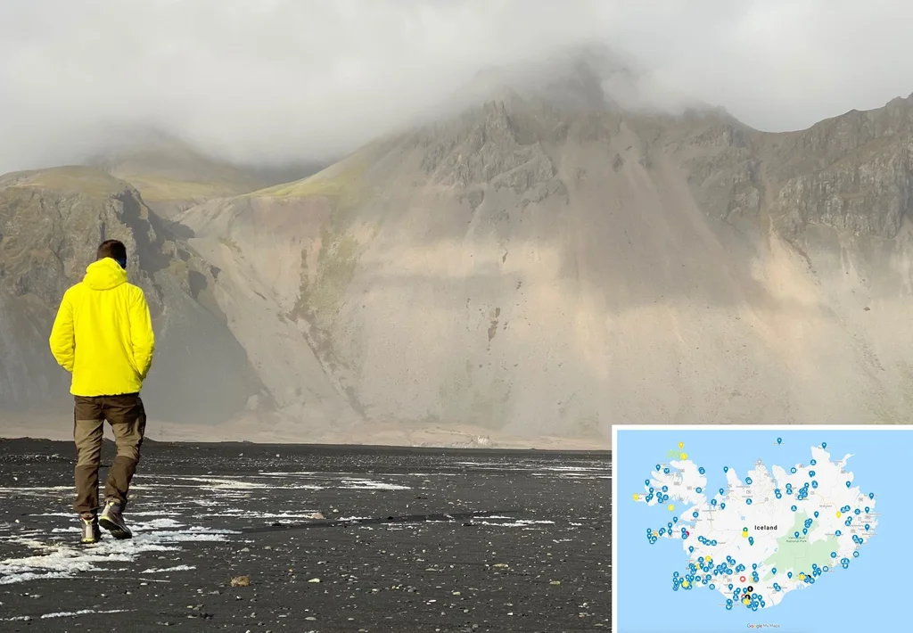
Read from 3,460 photo timestamps, 11 logged hikes, one logged coast walk and the GPS line across Iceland over 32 autumn days.
The argument
Thirty-two days back in Iceland, four months after the summer Ring Road. Two long anchors carry the trip: six nights at Sandgerði on the windswept Reykjanes flats, six more at Reykjahlíð on Lake Mývatn. We took fewer photos per day than in summer - about half the rate - and we let single places hold us for a week at a time. The peak days are the ones with logged hikes: the Háifoss valley, the Hekla rim, the Þingvellir rift walk, Krafla’s lava field, and the south-coast plane wreck. We closed on Nov 1, two weeks before Iceland’s late-autumn restrictions tightened.
Trip shape
REYK7d
S+W7d
SNF2d
MYV6d
SE-S7d
REY3d
Reykjanes baseSandgerði slow week
S + W detoursÞingvellir + Golden Circle
Snæfellsnesshorter than summer
Mývatn ★longest anchor
SE + S coast loopHöfn + Vík
Reykjavik closeReykjadalur + exit
Pace · photos per day
↑arrive
↑Háifoss day
↑Hekla rim
↑Þingvellir
↑Goðafoss
↑Dettifoss
↑Krafla
Frame data
Duration
32 days · 31 nights
Countries
Iceland · 1 effective (DE transit at Frankfurt)
Hull area
similar Ring Road extent · skipped the West Fjords this time
1 logged hike · Oct 7 Hafnarberg Sea Cliffs Extended (6.5 km / 62 m) · plus an Oct 4 logged coast walk out of Sandgerði (4.0 km)
Shape
base + walking extensions
Anchor
Sandgerði (6 nts)
Pace
slow / resident-mode
A whole week settled on the Reykjanes flats - unusual for us. We normally move every day or two; this one read as deliberate slow-living before the road trip began.
Oct 1 · the long arrival via Frankfurt and Keflavik, then a quiet first night on the Reykjanes flats
Oct 2-3 · settling into Sandgerði, an unhurried fishing-village rhythm, with a walking loop through Garður next door
Oct 4 · a flat coastal walk along the Sandgerði shore, the logged one
Oct 5-6 · slow resident-mode days, one of them touching Reykjavik, and a late-afternoon swing out to the Reykjanesviti lighthouse with the Gunnuhver hot springs and the Valahnúkamöl cliffs
Oct 7 · the Hafnarberg Sea Cliffs hike to close the slow opening week
02
S Iceland + West detour
8 → 14 Oct · 7 days
Photos
870
Hikes
5 logged hikes · Oct 8 Haifoss Falls (4.7 km / 234 m) · Oct 9 three walks (Rauðaskál Volcano · Rauðufossar · Laugavegur, 7.4 km total) · Oct 12 Öxarárfoss and Almannagjá Trail (6.8 km / 85 m) · Oct 13 Syðri-Rauðamelskúlur (1.0 km / 109 m)
Shape
moving · loops out and back
Anchor
no multi-night base · transit week
Pace
active touring
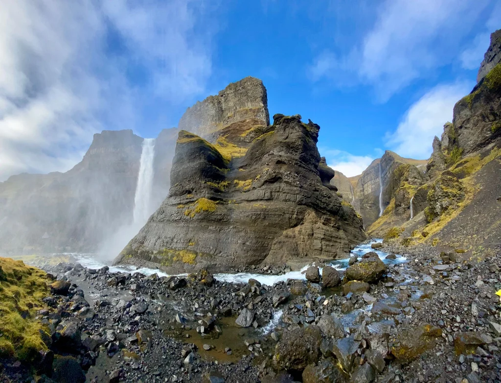
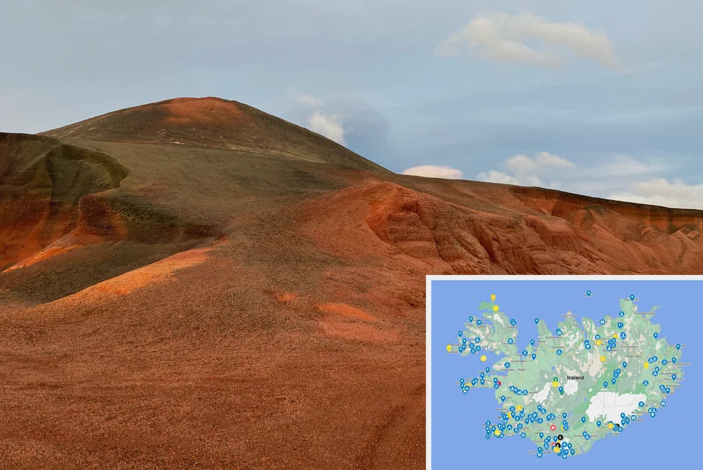
Oct 8 and Oct 9 back to back - the trip’s two photo-densest days, both spent in the south interior. Háifoss in the Þjórsárdalur valley one day, the Hekla rim and Rauðufossar pink waterfalls the next.
Oct 8 · the trip waking up - up to Háifoss, then a long Þjórsárdalur afternoon along the valley with extra stops at the Hekla-edge viewpoints
Oct 9 · the densest day of the trip - three walks stitched together on the Hekla edge: Rauðaskál volcano, the Rauðufossar pink rhyolite waterfalls, and a short stretch of the Laugavegur, plus a return drive across the Fjallabak interior
Oct 10 · the Golden Circle proper - the steaming Geysir basin and Gullfoss thundering at the rim, then west through Borgarfjörður
Oct 11 · a quieter day around Kerið crater and the south Þingvallavatn shore, then the Laugarvatn base
Oct 12 · ★ Öxarárfoss and the Almannagjá Trail at Þingvellir - the continental rift walk between the North American and Eurasian plates - then south along the Nesjavellir geothermal corridor toward the lake
Oct 13 · west Iceland - the Borgarnes / Reykholt / Bifröst corridor, then the short steep Syðri-Rauðamelskúlur climb on the Eldborg approach, a conical lava ring above the south Snæfellsnes coast
Oct 14 · a transit day with little kept
03
Snæfellsnes (shorter visit)
15 → 16 Oct · 2 days
Photos
290
Shape
linear · peninsula coast
Anchor
no multi-night
Pace
standard
Shorter than the summer-trip’s 3-day Snæfellsnes, but the off-the-road landings still come through: the Bjarnarfoss + Búðir corner one afternoon, Lóndrangar and Djúpalónssandur under Snæfellsjökull the next.
Oct 15 · across the Berserkjahraun lava field to the south Snæfellsnes coast - Bjarnarfoss waterfall, then the black church at Búðir and the lava-edge coast to Ólafsvík
Oct 16 · the western tip under Snæfellsjökull: the Lóndrangar sea-stack cliffs, the long Djúpalónssandur and Dritvík cove walk on black pebbles, then back through Hellissandur and Grundarfjörður
04
Mývatn ★ - the longest single-anchor stay
17 → 22 Oct · 6 days
Photos
1,090
Hikes
2 logged hikes · Oct 18 Lake Mývatn South Loop (1.9 km / 59 m, the Skútustaðir pseudo-crater shore) · Oct 20 Námafjall from Hverir (3.8 km / 161 m)
Shape
base + radial day-trips
Anchor
Reykjahlíð (6 nts) - the longest anchor of the trip
Pace
deep-dwell
Six nights at Reykjahlíð - off-baseline for an Iceland visit. Most people give Mývatn one or two days; we spent nearly a week, with day-trips fanning out to Goðafoss, Aldeyjarfoss, Húsavík, Dettifoss and the Krafla lava field.
Oct 17 · the long quiet drive in to the Mývatn base
Oct 18 · settling into Reykjahlíð with the Lake Mývatn South Loop around the Skútustaðir pseudo-craters, plus a detour south to the basalt-columned Aldeyjarfoss and then north to Goðafoss on the way back
Oct 19 · ★ over the Tjörnes peninsula to Húsavík, a swing through Ásbyrgi canyon, then the long afternoon at Dettifoss east bank - the trip’s loudest waterfall
Oct 20 · the geothermal heart - up Námafjall from the boiling Hverir mud pools, then north to Krafla and the Leirhnjúkur lava field
Oct 21 · a long walk through the Krafla / Leirhnjúkur complex - eight stops over two hours through the 1984 lava with steaming fumaroles - then Dimmuborgir’s lava maze in the late afternoon
Oct 22 · winding the long Mývatn stay down with a drive east across the highland edge, past Stuðlagil canyon and through the inner East Fjords toward Egilsstaðir
05
SE + S coast loop
23 → 29 Oct · 7 days
Photos
437
Hikes
1 logged hike · Oct 26 Sólheimasandur Plane Wreck (7.3 km / 40 m)
Shape
linear E → S
Anchor
Vík (2 nts)
Pace
steady
Oct 23 Stokksnes, the dunes-and-peaks corner with Vestrahorn rising over the black sand, and Oct 26 the Sólheimasandur Plane Wreck - the 7.3 km flat walk out across the black-sand plain to the DC-3 fuselage.
Oct 23 · down through Reyðarfjörður on the inner East Fjords, then south to Stokksnes with Vestrahorn over the black-sand peninsula, and on to Jökulsárlón at the foot of the Vatnajökull ice cap
Oct 24 · the south-coast glacier lagoons - Fjallsárlón twice from different angles, then Skaftafell on the run west
Oct 25 · Kirkjubæjarklaustur and the mossy Fjaðrárgljúfur canyon, then the Hjörleifshöfði promontory east of Vík
Oct 26 · ★ Dyrhólaey arch and Reynisfjara stacks in the morning, then the Sólheimasandur Plane Wreck walk out to the DC-3
Oct 27 · a near-silent rest day at Vík
Oct 28 · Skógafoss, the Sólheimajökull glacier tongue and Seljalandsfoss on the south-coast falls run
Oct 29 · the drive west, winding back toward the capital
06
Reykjavik close
30 Oct → 1 Nov · 3 days
Photos
102
Hikes
1 logged hike · Oct 30 Reykjadalur Hot Spring Thermal River · 9.3 km / 356 m (the trip's longest single hike)
Shape
linear · hot-river walk + exit
Anchor
Reykjavik
Pace
wind-down + hot springs
Oct 30 Reykjadalur Hot Spring Thermal River · 9.3 km / 356 m - the trip’s longest hike, up the steaming valley above Hveragerði and a soak in the warm stream at the top.
Oct 30 · ★ up the Reykjadalur hot-river valley above Hveragerði and back, finishing in the warm stream itself
Oct 31 · a near-empty pre-departure rest day
Nov 1 · the way home, Reykjavik and the Frankfurt return chain
Cross-leg memory
Facts visible only at trip scale.
Anchor stays vs summer trip
Sandgerði 6 + Mývatn 6 + Garður 4 = 16 of 32 nights at 3 anchors
Photo density delta
108 / day · half the summer-trip's 249 / day
Hike density
11 hikes across the 32 days · 48.8 km · 1,455 m ascent
Drive distance
~5,870 km on the GPS line
West Fjords
skipped - covered in the summer trip 2 months prior
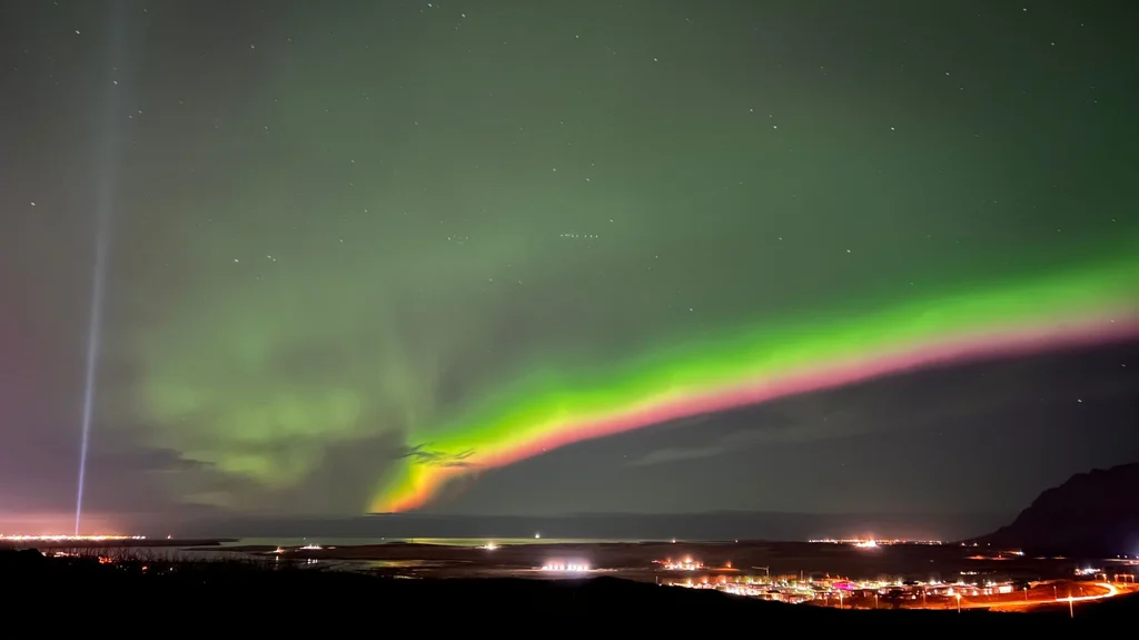
Aurora season
October at 64°N is first aurora season - visible but not photographed dramatically in this dataset
Second IS trip same year
4 months after the summer Ring Road
Off-path · per zone
Sandgerði base (Reykjanes)~90%1,700-resident fishing village
Golden Circle (Oct 10)~0%canonical
Þingvellir + W Iceland~30%canonical NP + less-touristed Eldborg / Bifröst
Time-of-day and season reframe matter more here than geographic off-path. October in Iceland is fall foliage, low light, early sunsets and the first aurora season. The trip skipped peak summer crowds entirely. The six-day Mývatn stay in October is the most off-baseline thing in the dataset - summer-Mývatn data doesn’t capture what off-season looks like at the same coords.
absentAurora photographyOctober at 64°N is Iceland’s first proper aurora season. A few late-evening clusters at Reykjahlíð and Dimmuborgir are consistent with auroras seen, but there is no coord-specific tripod-style night-photo signature in the dataset. We saw them; we did not chase them photographically.
absentWest FjordsVisited in the summer trip two months prior; not on the autumn route. Reasonable trade.
absentWestman Islands (Vestmannaeyjar)Same absence as the summer trip - never on either Iceland route. The gap eventually gets filled in spring 2021.
absentReykjavik nightlifeDespite multiple Reykjavik days, no late-evening urban clusters. We kept early hours.
absentF-road interiorLate October F-roads start to close for winter. The data shows no Þórsmörk coords this trip - the Oct 9 Laugavegur walk is a short edge-of-Hekla stretch, not the multi-day traverse.
absentWhale-watching boat tourThe Oct 19 stop in Húsavík was a brief through-visit on the way back from the NE corner, not a tour - no harbour-cluster of photos at sea level, no boat-track signature.
A slower-paced ’live in Iceland’ autumn trip - fewer regions, longer base stays, autumn-light photography rather than summer-crowd-touring. The six-night Reykjahlíð anchor is the most-distinctive structural feature.
Numbers
Single-day peak
291 photos · Oct 9 · Hekla rim + Rauðufossar
Second peak
255 · Oct 8 · Háifoss + Þjórsárdalur
Mývatn peak
252 · Oct 19 · Dettifoss east bank
Photos / day average
108
Longest anchor
Reykjahlíð 6 nights (Mývatn area)
Longest single hike
9.3 km / 356 m · Oct 30 · Reykjadalur
First photo (away)
2020-10-01 · Reykjanes peninsula
Last photo (away)
2020-11-01 · Reykjavik / Frankfurt return chain
From this trip
Where this trip surfaced elsewhere on Travelfoss. Public-facing posts and itineraries, drawn from the same days the data describes.
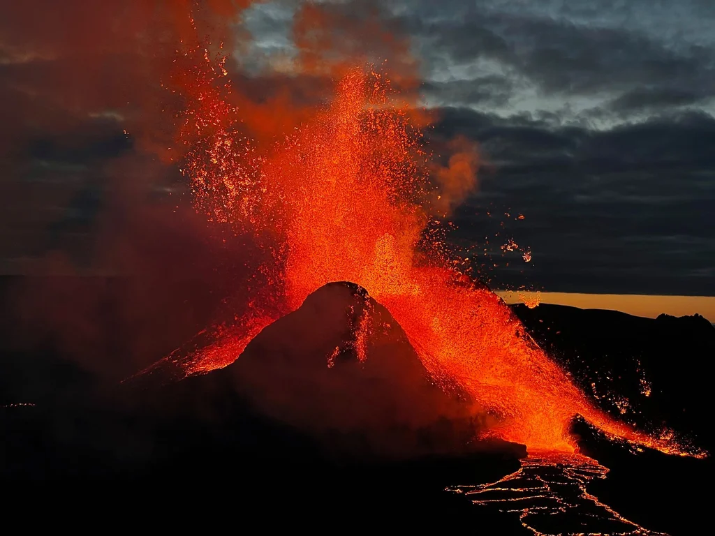
Standing next to an erupting volcano is surreal. Words, photos and videos don't make justice to being there. Feeling all the heat and the tremor and the colors is an outstanding experience. Though, …
Iceland is a country, but it feels like a different planet. It's been our second home and we know it inside out, including the top highlights for any itinerary.
Night photography has always been a challenge. Luckily, your iPhone can make very good Northern Lights shots even if you're holding one for the first time.