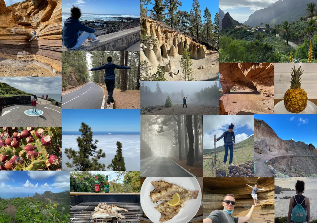
Thirty-six days, 3,813 photos, our first 100-km hike trip
21 February - 28 March 2021
Read from 3,813 photo timestamps and 20 logged workouts (16 hikes + 4 walks) across 36 days, cross-checked against the user's own Tenerife itinerary article.
The argument
36 days in the Canary Islands - 31 in Tenerife at La Orotava, then a 5-day pivot to Gran Canaria - across late winter into early spring 2021. 3,813 photos · 103.7 km recorded across 20 hikes, our first 100-km hiking trip. The structural signature is an extended-stay base at La Orotava (~600 m above sea level on Mt Teide’s northern flank) used for some twenty different excursions across the entire island. The trip’s highest hike crests at 2,350 m on 11 March - the Teide upper trails, almost certainly the Refugio de Altavista access. An open destination in a closed-Europe winter.
Trip shape
TF-17d
TF-29d
TF-311d
TF-43d
GC6d
Tenerife · sweep weekregional scan
Tenerife · mid rhythmtwo 200+ peaks
Tenerife · Teide + Tenoaltitude + longest hikes
Tenerife · wrapfinal sweep
Gran Canaria ★Roque Nublo + N coast
Pace · photos per day
↑arrive
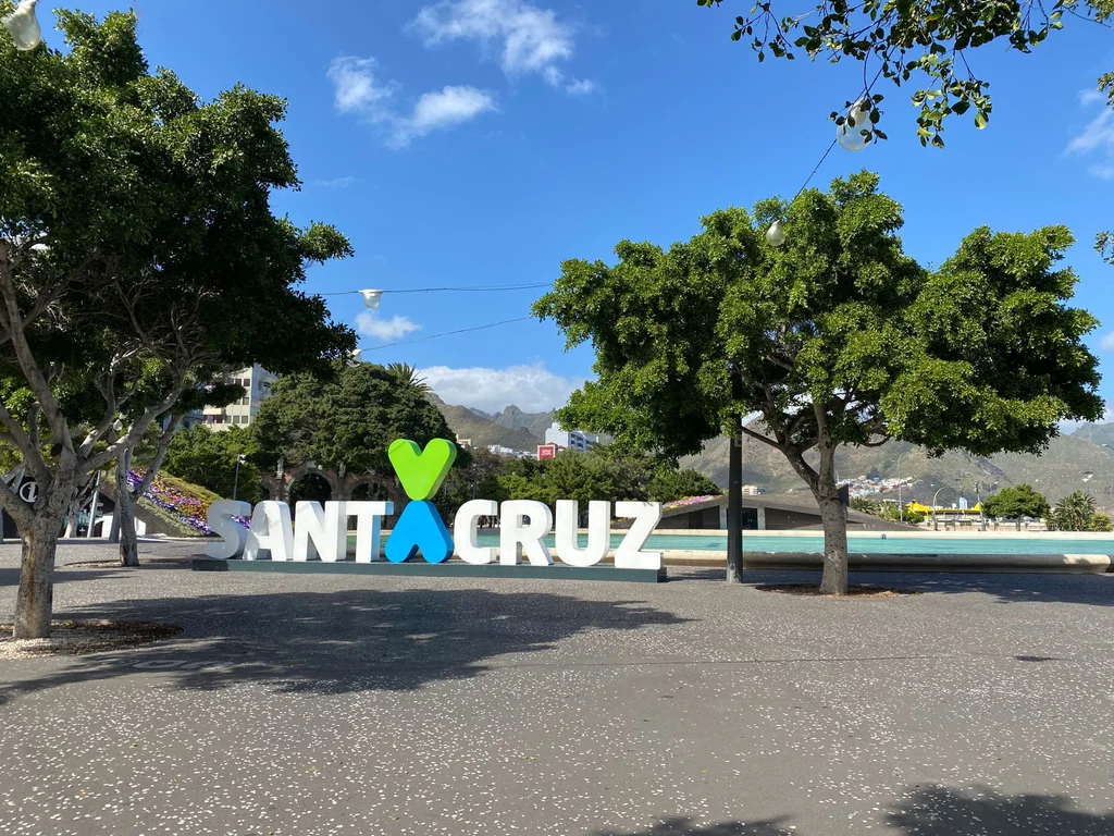
↑Santa Cruz 220
↑Arona 222
↑Santa Cruz 205
↑La Orotava 232
↑Agaete 194
↑S. Bartolomé 201
The signature
Mar 19 · Buenavista del Norte - the trip's longest single hike
13.3 km / 746 m through the Teno Massif on Tenerife's NW edge - among the longest walks of any single trip we'd done through 2021.
Distance
13.3 km
Ascent
746 m
Region
Teno Massif (NW Tenerife)
Context
Day 27 of 36 · third 700m+ hike of the trip
The Teno Massif is Tenerife’s NW corner - rugged-coast hike paths through the island’s oldest volcanic region. The Punta de Teno route runs out to the lighthouse at the island’s westernmost tip, with cliff-top vantages over the Atlantic - the kind of trail that asks for a 7-hour day.
Frame data
Duration
36 days · 35 nights
Country
Spain · 1 effective (Canary Islands)
Islands
2 of 7 (Tenerife · Gran Canaria)
Hull area
Tenerife ~70 km diameter + Gran Canaria ~50 km · 60 km ferry gap
Anchors
La Orotava (31 nts · Tenerife) · Gran Canaria E (4 nts)
Path shape
home - Madrid transit - Tenerife 31 days - GC 5 days - home
Photos
3,813 (all ES)
Hikes
20 logged · 103.7 km · highest at 2,350 m (Mar 11)
Hike density
~57% of trip days have a logged walk
The six legs
01
Tenerife at La Orotava ★★
21 Feb - 22 Mar · 31 days
Photos
3,200
Hikes
17 logged · 96.7 km · max elev 2,350 m
Shape
single-anchor · radial excursions across the whole island
Anchor
La Orotava (31 consecutive nights)
Pace
hike-dense
Mar 19 ★★ Buenavista del Norte 13.3 km / 746 m - the trip’s longest single hike (Teno Massif, Punta de Teno route).
Feb 21-27 · the opening week feeling out the island - the Anaga laurel forests on the Chamorga-Roque Bermejo line, the Güímar Malpaís badlands, the Teide caldera floor at Roques de García and the Mirador de las Minas de San José - the first scan of every corner from the new base
Feb 28 - Mar 8 · the mid-trip rhythm settling in, with the two big city days at Santa Cruz and La Laguna, a long Casa del Vino afternoon at El Sauzal on Mar 2, a south-coast village tour through Vilaflor and Arona on Mar 5, the Los Cristianos seafront breather on Mar 6, and a hard Anaga ascent at Las Vueltas de Taganana
Mar 9-19 · the altitude-and-distance stretch - the Paisaje Lunar twin hikes out of Vilaflor, the Teide upper trail near 2,350 m, and the long Teno traverses out of Buenavista (Callejón de Teno - Cumbre de Baracán on Mar 14, Punta de Teno on Mar 19) that close on the trip’s biggest walk
Mar 20-22 · the Tenerife wrap, the Chinyero lava-cone circular near Santiago del Teide on Mar 22 and a last broad sweep across the island - including a Santa Úrsula vineyard stop on Mar 21 - before the ferry
02
Gran Canaria ★
23 - 28 Mar · 6 days
Photos
620
Hikes
3 logged · Mar 24 Roque Nublo 3.8 km at 1,727 m
Shape
moving base · interior + N coast
Anchor
Telde / Las Palmas E
Pace
mini-island tour
Mar 25 ★ N + W Gran Canaria · 194 photos across 9 localities - the trip’s broadest single-day breadth.
Mar 23 · the ferry over and arrival around Telde and Las Palmas
Mar 24 · up into the Gran Canaria interior, the Tejeda highlands, the Roque Nublo summit walk, and an afternoon loop through the old town at Agüimes and the Valsequillo hill villages on the way back to Telde
Mar 25 · ★ the broadest day of the trip, a long loop through the green north and west - Arucas, Agaete, Moya, Gáldar - with the Guayedra cove walk on the Agaete coast
Mar 26 · more of the north and west coast at a gentler pace, with the Camino de la Laurisilva through the Los Tilos de Moya laurel forest
Mar 27 · a full last day around the south, Las Palmas and Telde
Mar 28 · the departure from Telde, the trip done
Cross-leg memory
Facts visible only at trip scale.
Hiking total
103.7 km across 20 walks (our first 100km+ trip)
Longest hike
13.3 km / 746 m · Mar 19 · Teno Massif (Punta de Teno)
Highest hike
max elev 2,350 m · Mar 11 · Teide upper trails
Tenerife regions hit
all 4 major hiking zones (Anaga · Teno · Teide centre · Adeje-Vilaflor SW)
Anchor duration
La Orotava 31 nights · among our longest single-anchor stays
Photo peaks
Mar 16 (232) · Mar 5 (222) · Mar 3 (220) · Mar 27 (201) · Mar 25 (194) - 5 days breaking 190
Off-path · per zone
La Orotava (base)~40%historic town, low intl photo density
Puerto de la Cruz / Santa Cruz~5%main Tenerife cities
Mt Teide trails (2,000-2,350 m)~0%top-decile global hike destination
Anaga / Teno NW~20%well-known among Tenerife hikers
Gran Canaria interior (Tejeda)~20%Roque Nublo area
Gran Canaria N coast villages~40%Agaete + Moya + La Aldea less-trafficked
The trip’s off-path lens is dominated by the breadth of Tenerife-hike-trail coverage: the user hit the Anaga (NE) + Teno (NW) + Teide (centre) + Adeje-Vilaflor (S) - all four major Tenerife hiking regions from one base. Few visitors do all four in one stay. Geographic-off-path scores are misleading per-coord; the trip’s interest is in the cross-region completeness.
absentPico del Teide summit (3,718 m)The Mar 11 hike at 2,350 m max is well below the summit - likely the cable-car upper-station + Refugio area, not the actual summit (which requires a permit and overnight in the refuge).
absentEl HierroOne of the four other inhabited Canary Islands. The user covered 2 of 7; the smaller islands not visited.
absentLa PalmaOne of the four other inhabited Canary Islands. The user covered 2 of 7; the smaller islands not visited.
absentLa GomeraOne of the four other inhabited Canary Islands. The user covered 2 of 7; the smaller islands not visited.
absentGarajonay National Park (La Gomera)Canary’s UNESCO-listed laurel forest - on a different island.
absentWhale and dolphin boat excursionThe SW resort coast was touched on a Mar 6 seafront walk, but the trip carries no offshore-tour coord cluster - the trademark Tenerife whale tour did not happen.
absentCarnival of Santa CruzTypically late February - this trip was just after the Feb 2021 carnival (largely cancelled / virtual that year due to COVID).
absentStar observatory at Teide (Izaña)World-class astronomy site - touched the area but no specific dwell.
absentTagananaAppears in the user’s own published Tenerife itinerary article but coord-check shows 0 photos this trip - visited at coords outside the named landmark’s footprint, or skipped.
absentPalmetumAppears in the user’s own published Tenerife itinerary article but coord-check shows 0 photos this trip - visited at coords outside the named landmark’s footprint, or skipped.
absentPlaya El BollulloAppears in the user’s own published Tenerife itinerary article but coord-check shows 0 photos this trip - visited at coords outside the named landmark’s footprint, or skipped.
absentMontaña AmarillaAppears in the user’s own published Tenerife itinerary article but coord-check shows 0 photos this trip - visited at coords outside the named landmark’s footprint, or skipped.
A fully-immersive Tenerife stay with a Gran Canaria coda. The user’s 20 recorded walks make this the year’s hike-centric crown - they came to walk this island, not to lie on its beaches. Confirmed against the user’s own itinerary: La Orotava + Santa Cruz + Buenavista + Roques de García + Garachico + Teno Alto + Paisaje Lunar + Roque Nublo + Anaga Cruz del Carmen + Benijo + Las Teresitas + Los Gigantes all show real coord clusters.
Numbers
Single-day peak
232 photos · Mar 16 · La Orotava + Adeje
Five 190+ photo days
Mar 16 (232) · Mar 5 (222) · Mar 3 (220) · Mar 27 (201) · Mar 25 (194)
Photos / day average
106
Longest hike
13.3 km / 746 m · Mar 19 · Teno (Punta de Teno)
Highest hike
max elev 2,350 m · Mar 11 · Teide
Hike density
20 of 36 days have a recorded walk (~57%)
Tenerife regions
all 4 major hiking zones from one base
Distance home - start
~3,400 km · flight via Madrid
First photo (away)
2021-02-21 · Madrid transit + La Orotava arrival
Last photo (away)
2021-03-28 · Telde Gran Canaria (departure)
From this trip
Where this trip surfaced elsewhere on Travelfoss. Public-facing posts and itineraries, drawn from the same days the data describes.
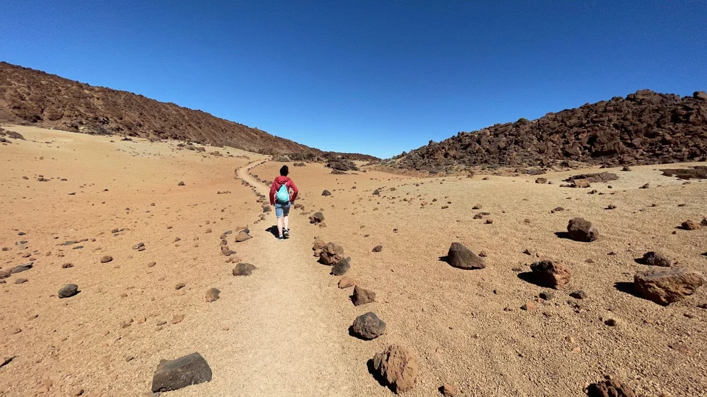
Hiking in Tenerife's Teide National Park is like hiking on the moon. At least this is how we think the moon looks like from the movies that were shot here.